
Image Details
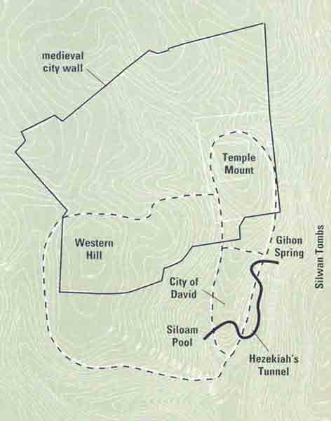
Tombs with a view. The map shows some of the major features of Jerusalem from the ninth to the sixth centuries B.C.E., when Israelite kings still ruled the city. The dashed lines outline the extent of the city proper, which consisted of the City of David (the earliest inhabited section of Jerusalem); the Temple Mount, on which Solomon built the Temple to Yahweh in the tenth century B.C.E.; and the Western Hill, to which Jerusalem’s well-to-do began moving in about the eighth century B.C.E. (The solid line on the map outlines the medieval wall that surrounds modern-day Jerusalem’s Old City.)
Also shown on the map are the Gihon Spring, Jerusalem’s main source of water in this period, and Hezekiah’s Tunnel, built by the eighth-century B.C.E. Judahite king to bring the spring’s waters inside the city’s walls. Lastly, tombs on the western side of the Kidron Valley, in the City of David, some have suggested, include the burial places of the Judahite kings.