
Image Details
Palestine Exploration Fund 25 (1893)
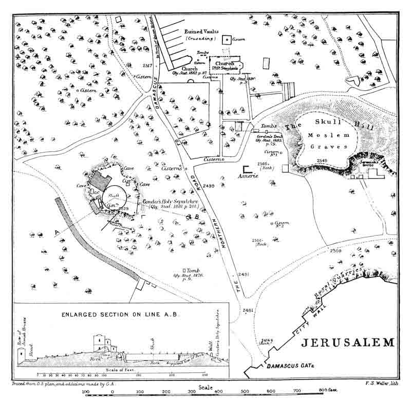
Herod’s Family Tomb located on Conrad Schick’s map of 1893. This map summarizes Schick’s findings based on probes he made in 1879 and 1893. After discovering sections of opus reticulatum wall Schick projected that they were part of a round structure, which he identified as a “shaft.” A section through the “shaft” is shown. Archaeologist Netzer, knowing about Schick’s earlier work, returned in 1977 to Schick’s site where he found more sections of the same structure, and realized that it was a double-walled circular structure (see plan). He identified it as Herod’s Family Tomb.
Some modern landmarks shown on this map are the Damascus Gate, Skull Hill or “Golgotha” a site identified by General Gordon of Khartoum in 1883 as the place of the crucifixion, and St. Stephen’s Church, located on the grounds of the École Biblique et Archéologique Française at the site of an important Iron Age cemetery and a later Byzantine basilica commemorating the stoning to death of St. Stephen.